Create by Text Interpolation
 Used to create a terrain model
from 2D "tagged" contours and interpolating 2D linear elements and textual
spots.
Used to create a terrain model
from 2D "tagged" contours and interpolating 2D linear elements and textual
spots.
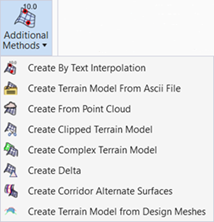
You can access this tool from the following:
The Create Terrain Model by Text Level Interpolation tool utilizes 2D files. The linear data is derived by locating spot elevations on longitudinal MicroStation elements and interpolating. Contours must be "tagged" with the elevation, while break lines and voids use text at each vertex to determine elevation. Therefore, two sets of filters must be defined; one for the Linear Features and a second filter for the elevation information.
General
|
Settings |
Description |
|
Text Filter |
Allows selection of Graphical Filters' for the required text. To refine the filter use Graphical Filter Manager. |
|
Linear Feature Filter |
Allows selection of Graphical Filters' for elements representing the text insertion point. |
|
Search Tolerance (in master units) |
Used for linear features only - If the text justification is within the specified search tolerance of a vertex, then the elevation is included for TM creation for the linear feature. If the text is not within the search tolerance of any linear feature graphic, then the elevation is ignored for inclusion on any linear feature. However, it may be included as a generic spot elevation depending if it matches the graphical filter for spot elevations. |
|
Include Text as Spot Levels |
Toggle on to look at all text in the drawing utilizing the justification point as the X,Y coordinates and the value of the text as the elevation and use as spot elevations. |
|
Opens the Terrain Filter Manager. |
|
|
Preview |
Previews the current filter selections. |
See also
Triangulation Options
Feature Definitions